

Top 10 Inspiring Blowing Rock Hikes

Nestled in the heart of North Carolina’s Blue Ridge Mountains, Blowing Rock is a hiker’s paradise. Whether you’re chasing cascading waterfalls, strolling around serene lakes, or tackling rugged mountain terrain, the trails here offer a little something for everyone.
From breathtaking views to peaceful forest paths, the magic of Blowing Rock hikes is waiting for you.
Blowing Rock’s hiking scene combines stunning landscapes with trails for every skill level. Whether you’re a seasoned adventurer or just looking for a casual nature walk, there’s no shortage of options to explore.
Let’s hit the trails!
1. Boone Fork Trail
Disclosure: Phoenyx Travels contains affiliate links and Phoenyx Travels is a member of the Amazon Services LLC Associates Program. Meaning Phoenyx Travels receives commissions for purchases made through those links, at no cost to you. Please understand that we have experience with all of these companies, and recommend them because they are helpful and useful, not because of the small commissions we make if you decide to buy something. See our Affiliates and Disclaimers Policy and Privacy Policy for more info.
Trail Details
- Difficulty: Moderate
- Length: 4.8 miles
- Duration: 1 hour, 55 minutes
- Elevation Gain: 524 feet
- Route Type: Loop
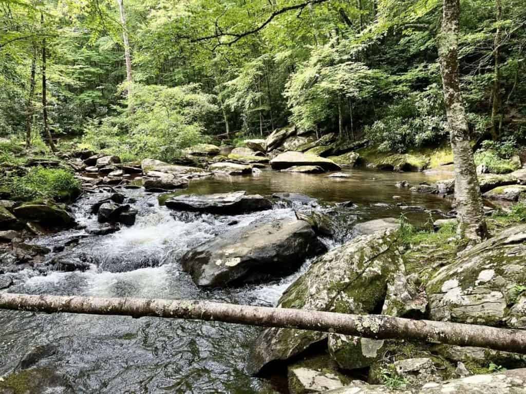
Boone Fork Trail offers a bit of everything: lush forests, wildflowers, and the highlight—Hebron Falls, also known as Boone Fork Falls. The trail’s variety makes it a favorite among hikers seeking a comprehensive experience of the area’s natural beauty.
Difficulty Notes: This trail provides an engaging challenge for seasoned hikers, with obstacles like boulder hopping, rocky terrains, and ladders. Numerous creek crossings add to the adventure.
There are also many creek crossings, and it is recommended to wear waterproof boots, or your feet will get wet. Hebron Falls is a great side trail to visit and relax by the cascading falls.
Accessibility + Inclusivity
Accessibility: The Boone Fork Trail has boulder hopping, rocks and roots in the trail, and some ladders along with uneven terrain.
Children:
- Ages 9+: A moderate challenge for kids in this age range, especially if they have some hiking experience. The adventurous nature of the trail might be appealing.
- Ages 12+: Best for older children with some hiking experience.
Dogs: It may be manageable for larger dogs who are more active, but you will need to be able to lift them over ladders.
Trail Map + Directions
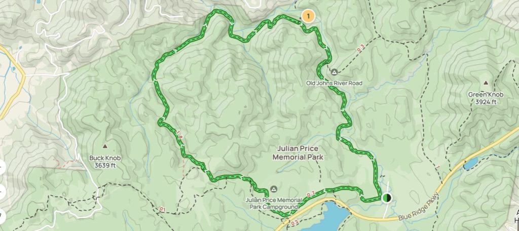
- From the Boone Fork Trail Parking area, turn left at the start of the trail.
- Follow the trail markers which make a complete loop back to the parking area.
2. Flat Top Mountain Trail
Trail Details
- Difficulty: Easy
- Length: 5.1 miles
- Duration: 2 hour, 5 minutes
- Elevation Gain: 593 feet
- Route Type: Loop
- Trailhead Location: Julian Price Memorial Park, Milepost 297 on the Blue Ridge Parkway
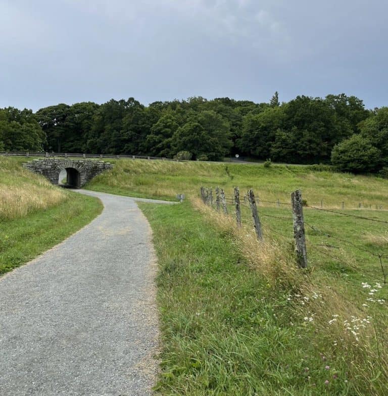
Flat Rock Trail is perfect for a quick and relaxing nature experience without venturing too far into the wilderness. The trail’s gentle terrain and shaded path make it ideal for warmer days, while the scenic rock formations add a touch of charm. It’s a go-to for locals and visitors alike who want to enjoy Blowing Rock’s natural beauty without a strenuous hike.
Note: The trailhead is easy to access, and the loop is well-maintained, but be prepared for some muddy patches after rainfall. Proper footwear is always a good idea!
Accessibility + Inclusivity
Accessibility: The Flat Top Mountain trail is known to have a moderate incline with some switchbacks and a gravel or rocky surface in parts.
Children: Aside from the length, this is a relatively moderate hike for kids. It is recommended to bring a stroller along.
Dogs: Just remember to keep your dog on a leash to ensure a safe and pleasant experience for all hikers, and pack some water and waste bags to keep the trail clean.
Trail Map + Directions
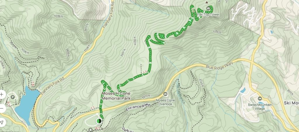
- Start at Moses Cone Manor: Follow the signposts and begin on the wide gravel path.
- Detour to Cone Cemetery (Optional): if you’re a fan of the macabre or looking for a local haunt, take this short detour.
- Navigate the Forest Switchbacks: Follow the winding path through the woods following the signposts.
- Enjoy Two Overlooks: Along the way to the summit, you’ll encounter two decent overlooks. Pause here, breathe in the fresh mountain air, and capture some photographs to remember these vistas.
- Reach the Summit & Fire Tower: When you reach the summit, where you’ll find the fire tower. Climb to the top for breathtaking 360-degree views that stretch as far as the eye can see.
3. Daniel Boone Scout Trail to Calloway Peak
Trail Details
- Difficulty: Hard
- Length: 7 miles
- Duration: 4 hours
- Elevation Gain: 2,240 feet
- Route Type: Loop
- Trailhead Location: Milepost 299.5 on the Blue Ridge Parkway, Grandfather Mountain State Park
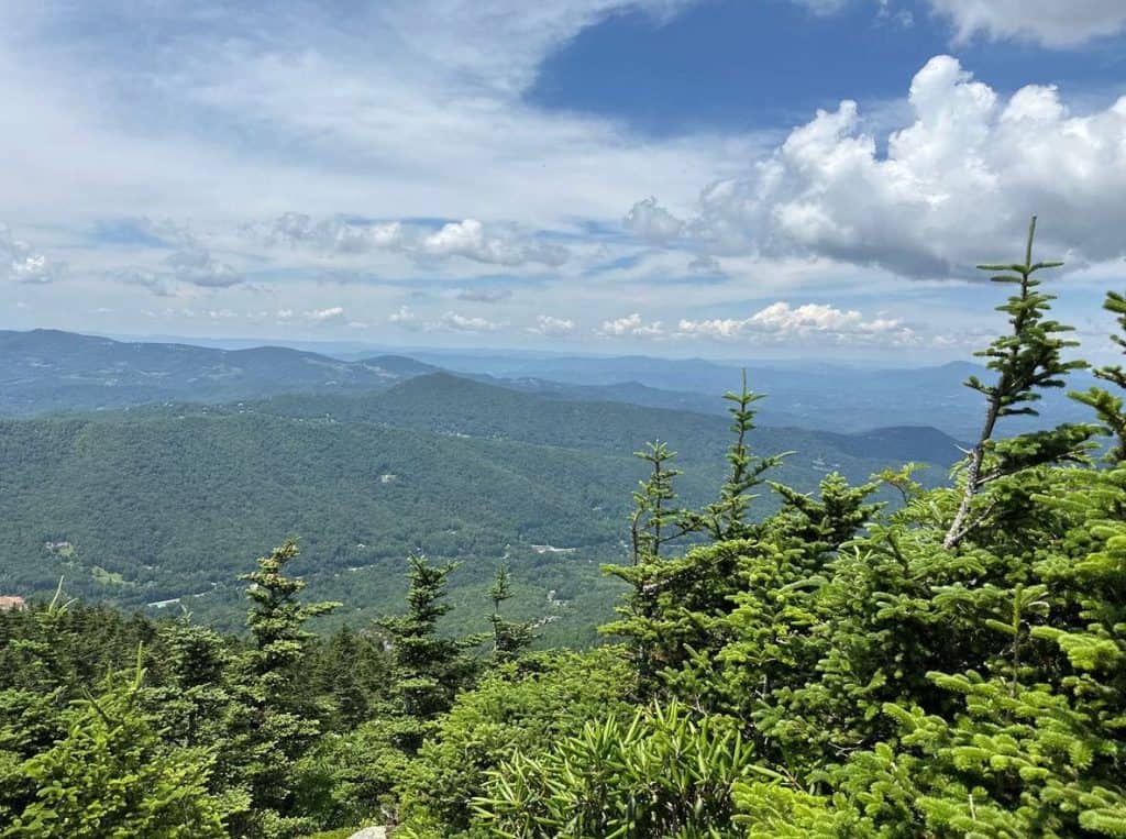
The Daniel Boone Scout Trail is a 7-mile round-trip hike that takes you to Calloway Peak, the highest point in the Blue Ridge Mountains at 5,964 feet. Rated as strenuous, this trail includes rocky sections, ladders, and breathtaking viewpoints, and a notable feature that’s intertwined with local history: a plane crash site.
As you hike, you may come across the remnants of this tragic event. While it serves as a somber reminder of the story embedded in the land, I urge you to approach this site with respect and reflection. Out of reverence for the life lost in this crash, please refrain from taking pictures or climbing on the wreckage.
If you’re ready to earn those panoramic mountain views, this trail is for you. The trek to Calloway Peak offers a mix of lush forests, rugged terrain, and jaw-dropping vistas. Along the way, you’ll encounter sections with ladders and cables that add a bit of excitement to the journey.
The summit rewards your effort with sweeping views of the surrounding peaks and valleys that are simply unforgettable.
Note: This trail is not for beginners or the faint of heart. Sturdy hiking boots, plenty of water, and a good level of fitness are essential. It’s also a good idea to start early to avoid afternoon storms common in the mountains. Hikers will need a permit for this trail. They are available at trail heads to fill out before you start hiking.
Accessibility + Inclusivity
Accessibility: The Daniel Boone Scout Trail to Calloway Peak is considered a hard trail for all hiking enthusiasts. While I am all for pushing your physical limits to see what you are capable of, please take extra care in the decision of if this hike is right for you so that there is no risk of injury.
Children:
- Ages 7-10: The adventure and challenge could appeal to kids in this age range who have previous hiking experience. Supervision, breaks, and safety measures will be crucial.
- Ages 11+: Older children with good physical endurance and a love for outdoor exploration might enjoy the trail, especially the unique features like ladders and boulders
Dogs: Although dogs are allowed on the trail, this trail contains ladders that dogs cannot climb. If the dog is not small enough to lift, it is not recommended to bring a pet on this route.
Trail Map + Directions
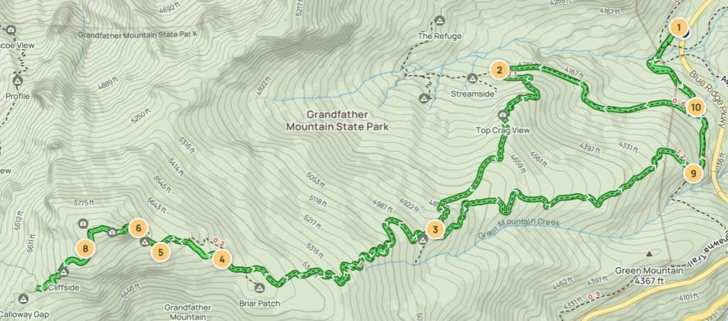
- Start at Boone Fork Parking Area: Mile 299.5 on the Blue Ridge Parkway is where your adventure begins. Cross a bridge over a bubbling stream and follow the Tanawha Trail for a tranquil half-mile to the Nuwati Trail junction. (36.11993, -81.78167)
- Cragway Trail: Prepare for a rocky and steep mile with jaw-dropping vistas. Your energy will thank you for conquering this vigorous climb early in the hike. (36.11819, -81.79072)
- Discover Flat Rock Trail Junction: Cragway Trail leads you to Flat Rock, where the landscape invites scrambling and offers stunning mountain views. From here, the trail to Calloway Peak unveils a unique ecological transition and a sprinkle of wildflowers in spring. (36.1116814, -81.7939627)
- Navigate an Arrow on the Rock: The summit’s rugged approach involves a treacherous scramble. Focus and careful stepping are vital; some hikers have even crab-walked back down. (36.11047, -81.80472)
- Find Shelter at Hi-Balsam Shelter: Look for a sign to this shelter, offering breathtaking views and refuge from unexpected weather. Backpackers might be sharing this cozy spot. (36.1107484, -81.8078033)
- Climb the Ladder to Calloway Peak: Three ladders lead you to the summit. Take your time and enjoy the exhilarating ascent. (36.11174, -81.80893)
- Descend with Caution: The way down is a mindful journey as well. Pace yourself and savor the views. (36.11179, -81.80918)
- Reach Calloway Peak Summit: The highest point on Grandfather Mountain is your rewarding destination. Embrace the views, and don’t linger too long; others want to share the magic. (36.1109, -81.81161)
- Head to the End of Daniel Boone Scout Trail: A relaxing walk back to the parking lot awaits you. Enjoy the flat terrain. (36.1139648, -81.7809391)
- Explore Nuwati Trail and Sign-In Registry: Sign in and keep a copy handy. Whether you continue on the Tanawha Trail or opt for the Scout Trail, splendid views will accompany your final stretch. (36.11667, -81.78081)
4. Glen Burney Trail

Trail Details
- Difficulty: Easy to Moderate
- Length: 2.3 miles
- Duration: 1 hour 14 minutes
- Elevation Gain: 538 feet
- Route Type: Out and back
- Trailhead Location: Annie Cannon Gardens on Laurel Lane, just steps from downtown Blowing Rock.
This out-and-back trail spans approximately 3.2 miles round trip, descending about 800 feet into the John’s River Gorge. Along the way, hikers are treated to views of three waterfalls:
- The Cascades: A series of smaller falls that set the tone for the adventure ahead.
- Glen Burney Falls: A stunning 30-foot waterfall that offers a refreshing mist on warmer days.
- Glen Marie Falls: The grand finale, standing at 55 feet, providing a serene spot to rest before the ascent back.
For those that yearn for a touch of adventure, the Glen Burney Trail can be a perfect escape within a day accessible just minutes from the downtown Blowing Rock area.
Known for its vibrant birding community and fellow hiking enthusiasts, this path offers not only communion with nature but the warmth of shared exploration, forging connections with both the land and like-minded wanderers.
The Glen Burney Trail offers a rugged experience close to town, making it a favorite for those seeking a quick yet rewarding adventure. The combination of lush forests, cascading waterfalls, and the challenge of the steep return hike ensures a memorable outing.
Note: The trail can be steep and slippery, especially after rain. Proper footwear is essential, and hikers should be prepared for the strenuous climb back to the trailhead.
Accessibility + Inclusivity
Accessibility:
- Cascades: The trail can be uneven and may require careful navigation. Exposed roots and rocks are on nearly all of the trail.
- Glen Burney Falls: Similar to the Cascades section, the path to Glen Burney Falls includes steeper and potentially more challenging terrain.
- Glen Marie Falls: This is the most demanding part of the hike, with steeper inclines and potentially slippery areas.
Children:
- Cascades
- Ages 4-12: Suitable with proper guidance. A mild challenge but a rewarding experience.
- Ages 13+: An engaging adventure. Perfect for teenagers looking to explore nature.
- Glen Burney Falls
- Ages 7-12: Feasible but demanding. Proper hiking equipment and guidance needed.
- Ages 13+: Suitable for teenagers seeking a bit more challenge. Good footwear essential.
- Glen Marie Falls
- Ages 9-12: Attempt with caution. This section is more strenuous and should be undertaken with proper preparation.
- Ages 13+: Suited for teens with hiking experience. Expect a rewarding but demanding hike.
Dogs:
- Cascades: Likely suitable for dogs, especially if they are used to hiking. Be mindful of the terrain, which can be uneven.
- Glen Burney Falls: Also likely suitable for dogs that are comfortable with a longer hike. Some steeper and potentially slippery sections may require extra care.
- Glen Marie Falls: This section may be the most challenging for dogs, especially smaller or less experienced ones. Consider your dog’s abilities, as this is the most demanding part of the hike.
Trail Map + Directions
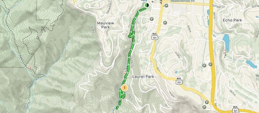
- After parking at the above address, turn left at the start of the trail.
- Follow the trail markers in and back out from the trail.
5. Green Knob Loop
Trail Details
- Difficulty: Moderate
- Length: 2.2 miles
- Duration: 1 hour 12 minutes
- Elevation Gain: 538 feet
- Route Type: Loop
- Trailhead Location: Sims Pond Overlook, Milepost 295.7 on the Blue Ridge Parkway.
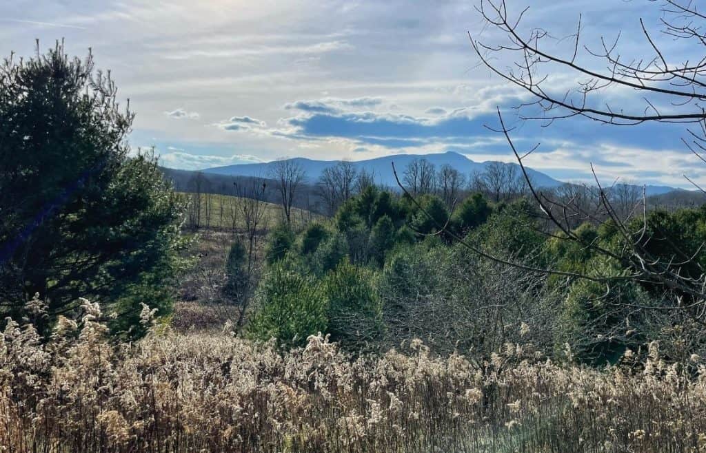
Gently winding through verdant forests, it leads you to meadows and several overlook spots, showcasing spectacular views of the surrounding Blue Ridge Mountains.
Ideal for hikers of various levels, the trail’s moderate difficulty and well-maintained path make it an inviting option for a fulfilling day’s exploration.
Green Knob Trail is perfect for hikers seeking a quieter, more secluded experience. The variety of landscapes and the peaceful sounds of nature make it a restorative hike. It’s also a wonderful choice for birdwatchers and anyone who appreciates a less-trafficked trail.
Note: Some sections may be overgrown in the summer months, so long pants are a good idea.
Accessibility + Inclusivity
Accessibility: The Green Knob Trail has uneven terrain, small rocks, and occasional steep sections.
Children:
- Ages 7-10: With a bit of guidance, kids this age should find the trail an exciting challenge. Pack some snacks, and they’ll likely keep up just fine.
- Ages 11+: These young explorers should handle the trail with ease, perhaps even leading the way.
Dogs: Just remember to keep your pup on a leash, as the trail may have some steep or uneven sections that could be a bit challenging for overly excited pups.
Trail Map + Directions
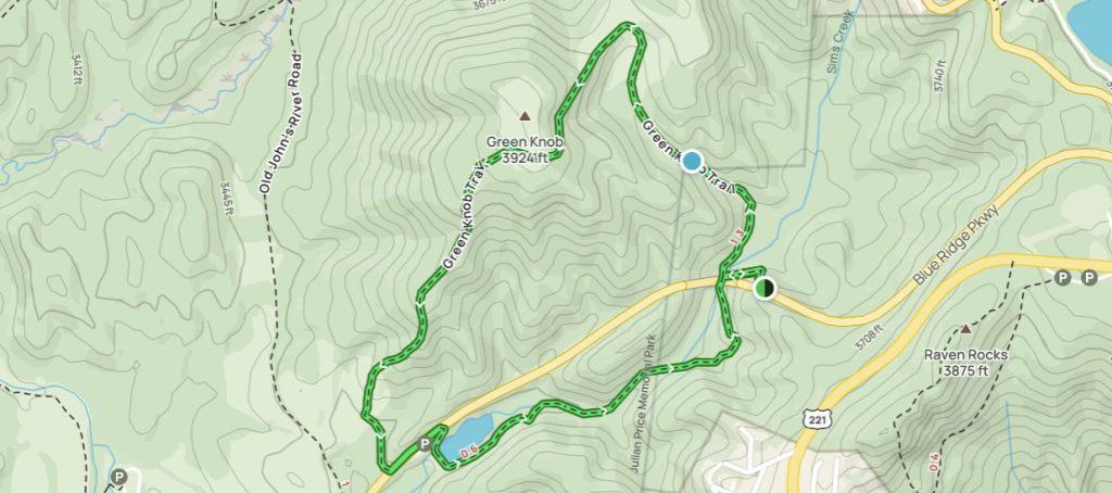
- After entering the trail through Sims Pond or Sims Creek parking area, follow the signposts to the right to complete the loop trail.
6. Price Lake Loop Trail
Trail Details
- Difficulty: Easy
- Length: 2.2 miles
- Duration: 42 minutes
- Elevation Gain: 72 feet
- Route Type: Loop
- Trailhead Location: Julian Price Memorial Park, Milepost 297 on the Blue Ridge Parkway.
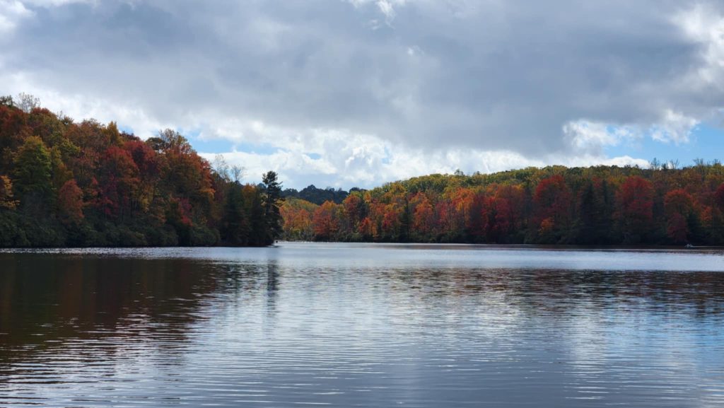
Price Lake Loop Trail, located at Julian Price Park in Blowing Rock, NC, is a scenic treasure that invites nature lovers of all kinds. Not only favored for walking and hiking but also serves as a popular spot for birding, camping, and reflection by the water’s edge.
The blend of lake reflections and the encompassing Blue Ridge Mountains create an idyllic setting, whether you’re pitching a tent for a weekend getaway or simply seeking a soul-soothing hike.
The trail provides serene lakeside views, opportunities for wildlife observation, and is particularly popular during fall foliage season. It’s also a great spot for canoeing and picnicking.
Note: Sections of the trail can be muddy after rainfall. Proper footwear is recommended.
Accessibility + Inclusivity
Accessibility:
Price Lake Loop Trail in North Carolina is generally considered to be a gentle and relatively accessible trail. However, it has gravel, dirt, and exposed roots.
Children:
- Ages 0-3: Might be a bit much for the youngest explorers. The trail isn’t too rugged, but a sturdy stroller or baby carrier would be the way to go.
- Ages 4-6: Little legs can handle this one with breaks. The lake’s views might spark their imagination – just watch them near the water’s edge.
- Ages 7+: This age range should enjoy the trail! Enough to explore, not too strenuous, and a good length for a rewarding family adventure.
Dogs:
This trail is generally considered to be dog-friendly! Just make sure your pup is on a leash.
Trail Map + Directions
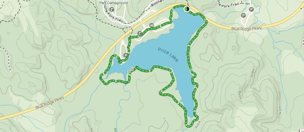
- Start at Price Lake Overlook.
- Go left over the bridge.
- Follow the trail into the woods.
- Note beaver signs on trees and muddy areas near the back of the lake.
- Follow the flat trail around the lake.
- Walk through the campground area.
- Return to the parking area.
7. Cone Manor, Bass Lake Trail, and Maze Loop
Trail Details
- Difficulty: Moderate
- Length: 6.3 miles
- Duration: 2 hours 20 minutes
- Elevation Gain: 508 feet
- Route Type: Loop
- Trailhead Location: Moses H. Cone Memorial Park, Milepost 294 on the Blue Ridge Parkway
Connecting the historic Cone Manor to Bass Lake, this path passes through woodlands and meadows, offering a glimpse of local flora and fauna.
Whether you’re an avid adventurer or seeking a peaceful escape, the trail’s blend of history and natural beauty makes it a popular choice in the area.
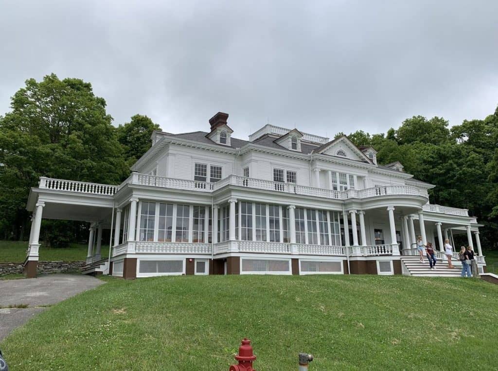
This trail system offers a perfect mix of historical charm and natural beauty. Start with the Cone Manor Trail, which leads you to the picturesque Flat Top Manor, a historic mansion with sweeping views of the surrounding mountains.
From there, descend to the serene Bass Lake Loop, where you can stroll along a flat path around the tranquil waters. For a bit of variety, add the Maze Loop, a peaceful forest trail that winds through dense woodlands and rolling hills.
Note: These trails are well-maintained and ideal for families or casual hikers. The Bass Lake Loop is particularly popular for its accessibility, but the steeper climbs around Cone Manor provide a bit more challenge for those looking to break a sweat.
Accessibility + Inclusivity
Accessibility:
The Cone Manor to Bass Lake Trail is partially paved with the rest being gravel and dirt trails. Another thing to assess is the length of the trail.
Children:
- Ages 0-3: Might be a bit much for the youngest explorers. The trail isn’t too rugged, but a sturdy stroller or baby carrier would be the way to go.
- Ages 4-6: Little legs can handle this one with breaks. The lake’s views might spark their imagination – just watch them near the water’s edge.
- Ages 7+: This age range should enjoy the trail! Enough to explore, not too strenuous, and a good length for a rewarding family adventure.
Dogs:
This trail is generally considered to be dog-friendly! Just make sure your dog is on a leash.
Trail Map + Directions
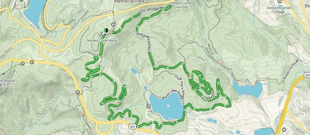
- After you have parked at Cone Manor, follow the signposts to hike the trail counterclockwise until you loop back to Cone Manor.
8. Flat Rock View Via Nuwati and Cragway Trail

Trail Details
- Difficulty: Hard
- Length: 3.9 miles
- Duration: 2 hours 15 minutes
- Elevation Gain: 1,046 feet
- Route Type: Out and back
- Trailhead Location: Julian Price Memorial Park, Milepost 297 on the Blue Ridge Parkway
The Flat Rock View via Nuwati and Cragway Trail near Blowing Rock, North Carolina stretches across a moderate distance offering a unique blend of fascinating landscapes and engaging challenges. Moving onward to the Cragway Trail, the path unfolds to reveal breathtaking vistas of the Blue Ridge Mountains, ultimately leading you to the Flat Rock View.
The dramatic overlooks combined with the intimate connection to the forest make this hike a memorable experience for those seeking both beauty and adventure in their outdoor pursuits.
Note: The trailhead is easy to access, and the loop is well-maintained, but be prepared for some muddy patches after rainfall. Proper footwear is always a good idea!
Accessibility + Inclusivity
Accessibility:
The Flat Rock View via Nuwati and Cragway Trail needs extremely careful consideration when assessing if it is right for you and your ability.
Personally, this trail proved to be one that I initially shouldn’t have attempted with my leg and ankle issues as I was laid up in bed the following day because of it.
Children:
- 12+: Kids 12 years old and older will enjoy this hike depending on their level of fitness and hiking prowess.
Dogs:
While dogs are welcome on a leash, this trail would prove difficult even for larger dogs due to the need to climb over large rocks and boulders.
Trail Map + Directions
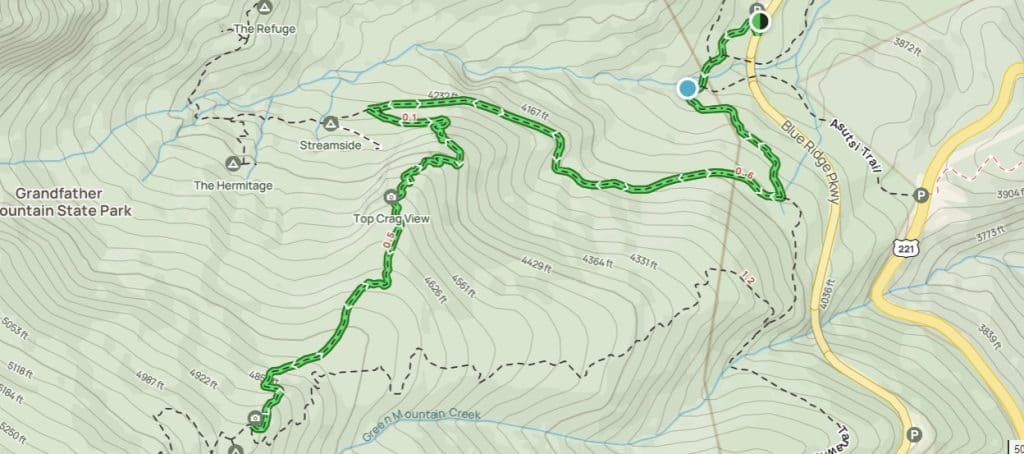
- After parking at the Boone Fork Parking area on the Blue Ridge Parkway, specifically at Mile Marker 300, locate the trail to the left of the parking area.
- Follow the Tanawha Trail by heading left onto it.
- Traverse a high bridge that takes you to the permit station, adding a touch of excitement to your journey.
- Keep your momentum going as you continue along the Nuwati Trail for a stretch of 0.6 miles, soaking in the natural beauty around you.
- When the time is right, make a left turn at the Cragway Trailhead – this will guide you onto the path leading to the Daniel Boone Scout Trail.
9. Bass Lake Loop Trail
Trail Details
- Difficulty: Easy
- Length: 0.9 miles
- Duration: 17 minutes
- Elevation Gain: 19 feet
- Route Type: Loop
- Trailhead Location: Access via Highway 221, approximately one mile from Main Street in Blowing Rock.
Bass Lake Loop Trail in Blowing Rock, NC, is a welcoming spot that invites walkers, joggers, and anyone who loves nature to come and soak in its gentle charm.
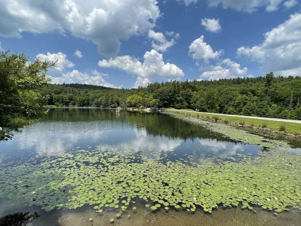
Winding around the picturesque Bass Lake, this easy loop offers the ease of a flat and well-maintained gravel path, surrounded by beautiful trees and foliage, serene views of the water, and the charming wooden footbridges.
The Bass Lake Loop is perfect for a leisurely stroll, offering picturesque views of the lake and the historic Moses Cone Manor in the distance. It’s a popular spot for locals and visitors alike, ideal for walking dogs, jogging, or simply enjoying the serene environment.
Note: The trail connects to a network of over 25 miles of carriage trails in Moses H. Cone Memorial Park, providing opportunities for extended hikes.
Accessibility + Inclusivity
Accessibility:
The flat and wide Bass Lake Loop Trail makes this a win for people of all abilities. Please be advised that walkers and wheelchairs may have more trouble with the dirt and gravel.
Children:
Kids of all ages will be able to enjoy this trail with ease.
Dogs:
All dogs are welcome as long as they are on a leash.
Trail Map + Directions
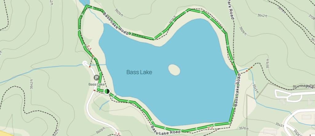
- After parking at the Bass Lake parking area, turn left following the signposts for the trail
- As it is a loop trail, just follow the signposts back to the Bass Lake parking area.
10. Rich Mountain Carriage Trail

Trail Details
- Difficulty: Easy
- Length: 5.8 miles
- Duration: 2 Hours 17 minutes
- Elevation Gain: 600 feet
- Route Type: Loop
- Trailhead Location: Moses H. Cone Memorial Park, Milepost 294 on the Blue Ridge Parkway
Rich Mountain Carriage Trail near Blowing Rock, NC, welcomes enthusiasts of cross-country skiing, hiking, and horseback riding. This trail winds through forests and meadows, leading to the summit of Rich Mountain and offering breathtaking views of the Blue Ridge Mountains.
This trail is perfect for those who want to immerse themselves in nature while enjoying a more serene, less crowded path. The Rich Mountain summit offers breathtaking views of the surrounding countryside, especially during the fall when the foliage is in full display.
Along the way, you’ll pass through historic carriage roads originally designed by Moses Cone, adding a touch of history to the scenic beauty.
Note: The trail is well-maintained, but the incline can be challenging for beginners. Bring plenty of water and a camera—the summit views are worth capturing. Keep an eye out for wildlife, as this trail is known for frequent deer and bird sightings.
Accessibility + Inclusivity
Accessibility:
The Rich Mountain Carriage Trail is 5.8 miles with an incline of 600 ft. with gravel and dirt footpaths.
Children:
- Ages 0-6: Little legs can handle this one with breaks.
- Ages 7+: This age range should enjoy the trail! Enough to explore, not too strenuous, and a good length for a rewarding family adventure.
Dogs:
The Rich Mountain Carriage Trail is known to be dog-friendly. Just be sure to keep your dog on a leash and follow any posted rules or regulations to ensure a safe and enjoyable experience for everyone on the trail.
Trail Map + Directions
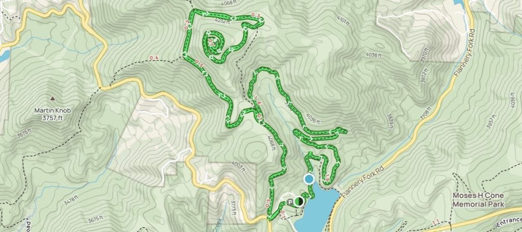
- At the gate, turn right.
- Follow the sign posts until the loop finishes back at the gate.
Blowing Rock Hikes Are Like no Other
These Blue Ridge Mountain trails offer more than just exercise—they provide a connection to the stunning landscapes and rich history of North Carolina. Whether you’re chasing waterfalls on the Glen Burney Trail or taking in the jaw-dropping views at Rough Ridge, each hike offers its own unique charm.
These trails cater to a variety of skill levels, so whether you’re a seasoned hiker or just looking for a leisurely stroll, there’s something here for everyone. Plus, the proximity to Blowing Rock’s charming downtown means you can reward yourself with a meal or a cup of coffee after your adventure.
Tips for Hiking
To make the most of your hiking experience, keep these tips in mind:
1. Check the Weather
Conditions can change quickly, especially in the mountains. Be prepared for sudden rain or cooler temperatures.
2. Dress for the Trail
Proper footwear and moisture-wicking clothing can make a big difference, especially on more challenging trails.
3. Bring Essentials
Always carry water, snacks, a map, and a small first aid kit, just in case.
4. Practice Leave No Trace
Respect the environment by packing out all trash and staying on designated trails.
5. Arrive Early
Popular trails can get crowded, especially during peak seasons like fall. Arriving early ensures a more peaceful hike.
Which Hike Will You Try First?
Blowing Rock has some of the most stunning and diverse trails in North Carolina. From accessible hiking trails to challenging mountain climbs, each trail offers an adventure that’s as beautiful as it is rewarding.
Whether you’re here for a weekend getaway or a longer stay, exploring these trails is a must for nature lovers and outdoor enthusiasts.
If you’re planning a trip to Blowing Rock, check out Chetola Lodge for the family or The Embers for a mountain retreat. Check out my guide to the best restaurants in Blowing Rock for some amazing eats and foodie finds for everyone!
And don’t forget to subscribe to my newsletter for more tips on outdoor adventures and accessible travel. Happy hiking! 🥾🌲


